Exploring the World's Skies: Introducing Density Maps on RadarBox.com
Density Maps provided by AirNav RadarBox
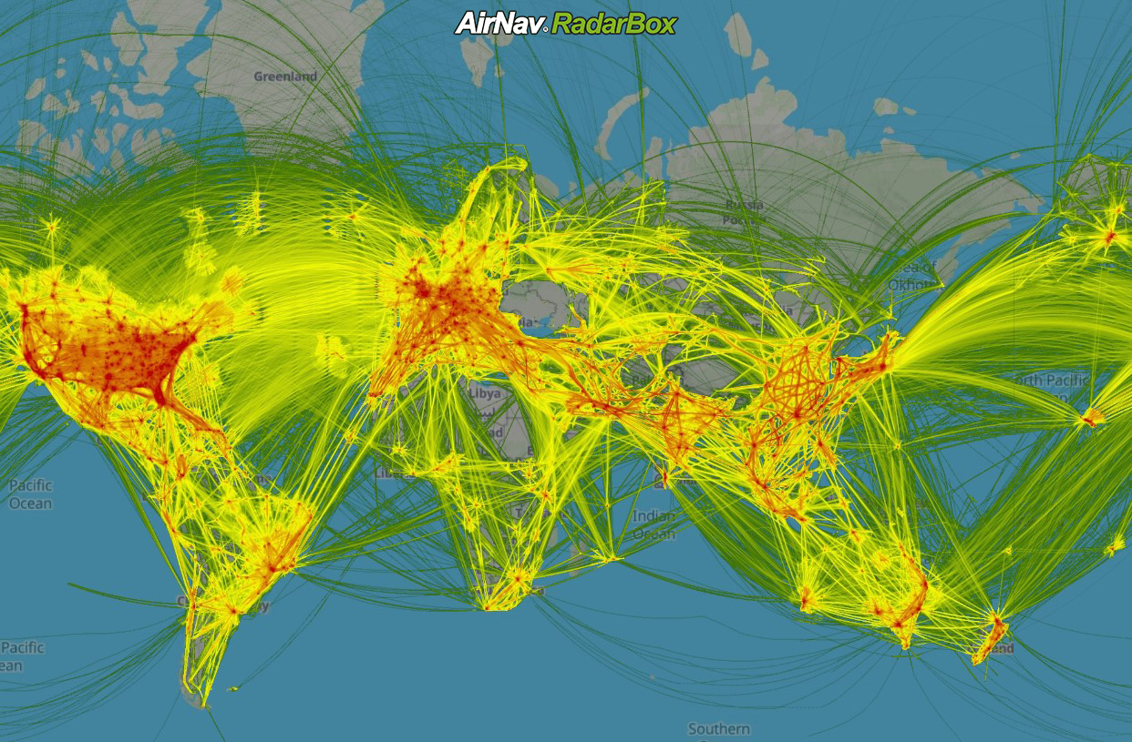
Are you ready to dive into the intricate web of global air traffic like never before? RadarBox.com is proud to introduce a groundbreaking feature that revolutionizes how you visualize aircraft movements: Density Maps. Imagine accessing a dynamic visual representation of aircraft positions over the last 7 days, seamlessly overlaid onto an intuitive map interface.
Density maps derived from the latitude and longitude of aircraft utilize a combination of GPS, Inertial Reference Systems (IRS), and other data sources. The essence of Density Maps lies in their ability to offer a comprehensive snapshot of aircraft activity over seven days. As you zoom in on the map, the fidelity of this layer magnifies, revealing intricate details that were previously unseen. What sets this feature apart is its ability to provide not just a generic overview but a granular exploration of flight paths, hotspots, and traffic patterns across the globe.
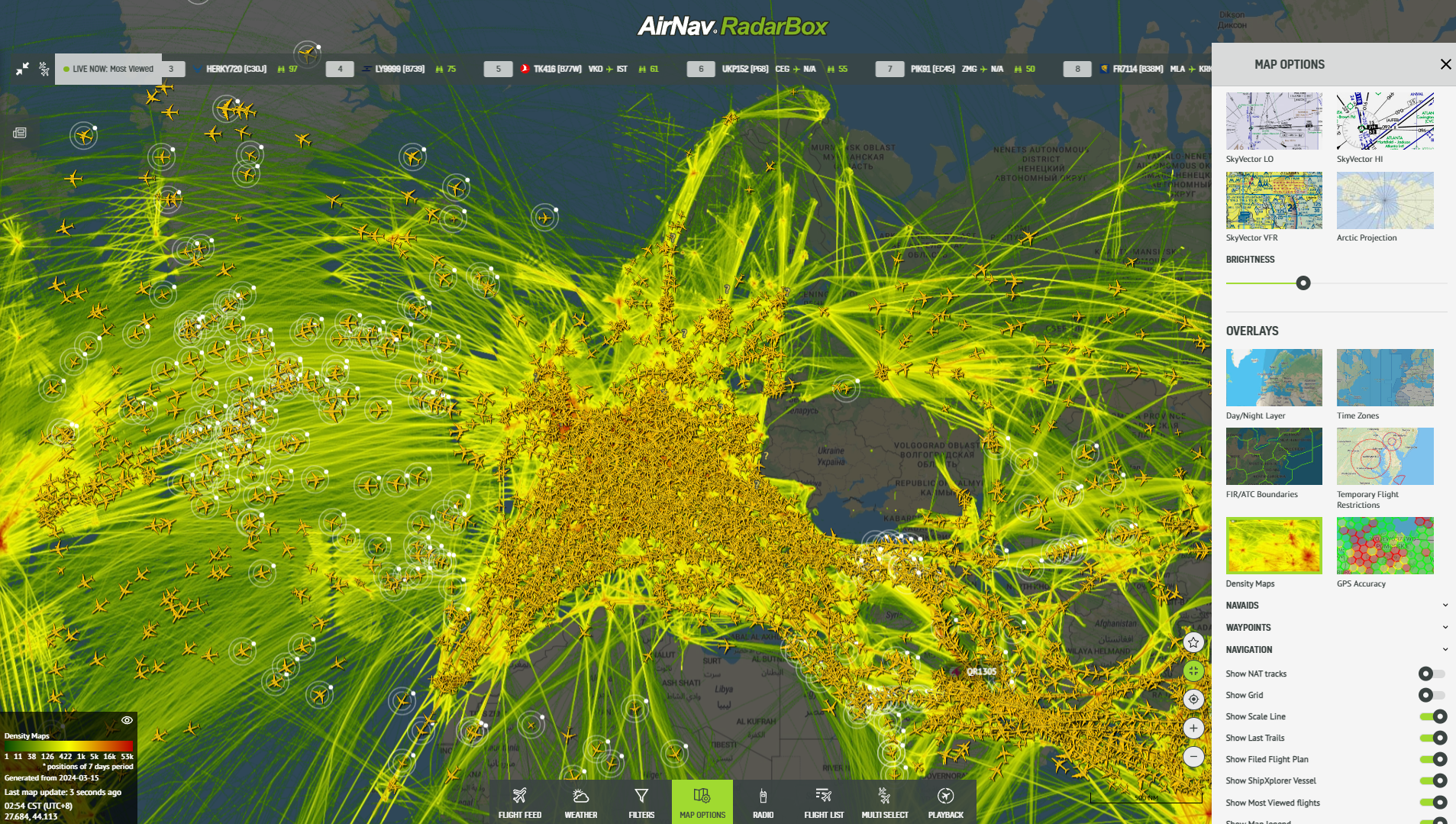
However, you can also identify essential elements such as high-altitude and low-altitude charts and Navaids directly with the density maps.
Density Maps provided by AirNav RadarBox
From High Altitude to Ground Detail
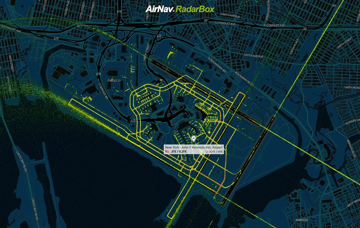
One of the most captivating aspects of Density Maps is their ability to seamlessly transition from a global perspective to a close-up view of individual airports. Picture yourself zooming in on an airport, and suddenly, the runway layouts emerge with crystal clarity. You can quickly identify the routes between gates and runways, gaining unprecedented insights into ground operations.
Density Maps provided by AirNav RadarBox
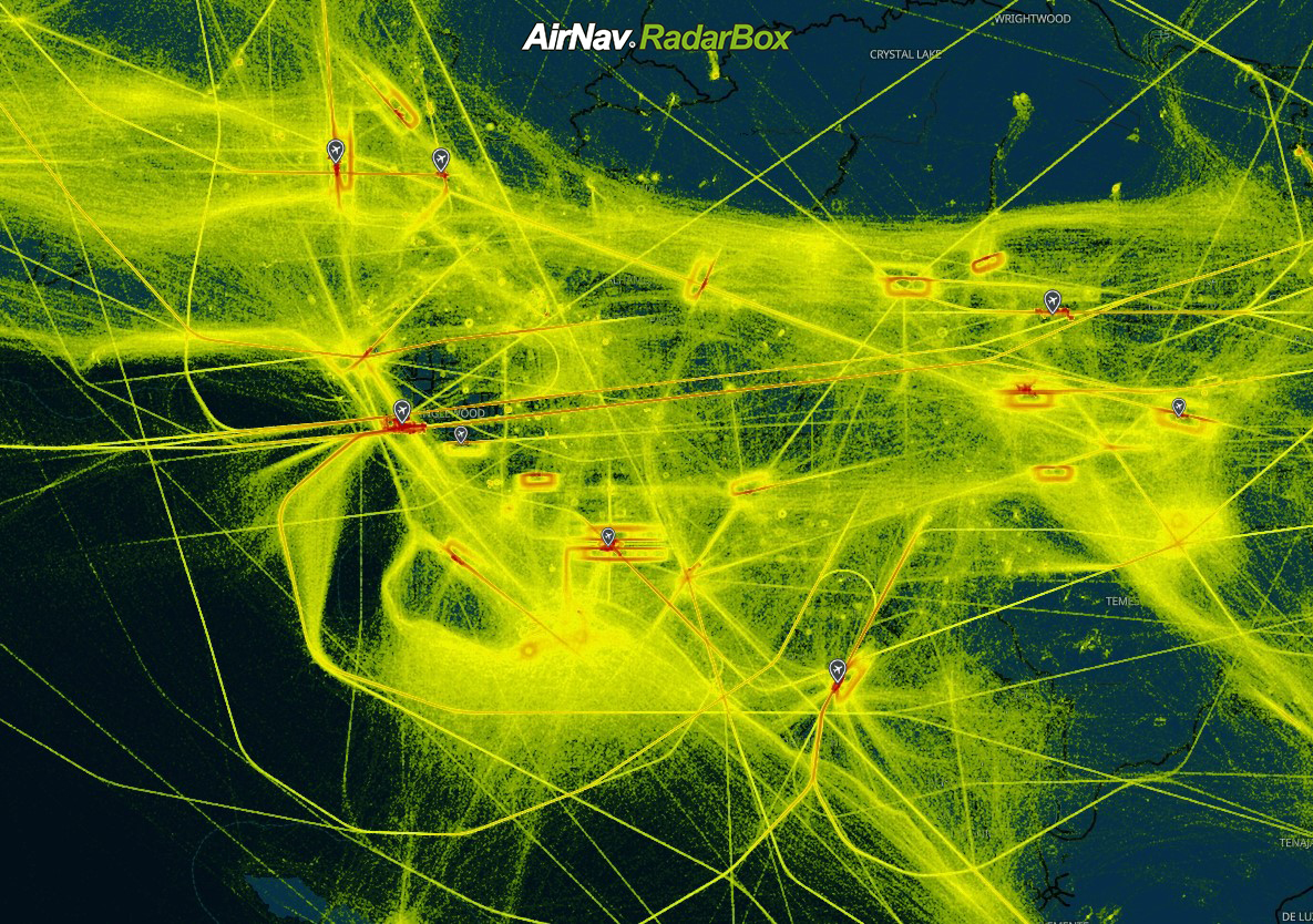
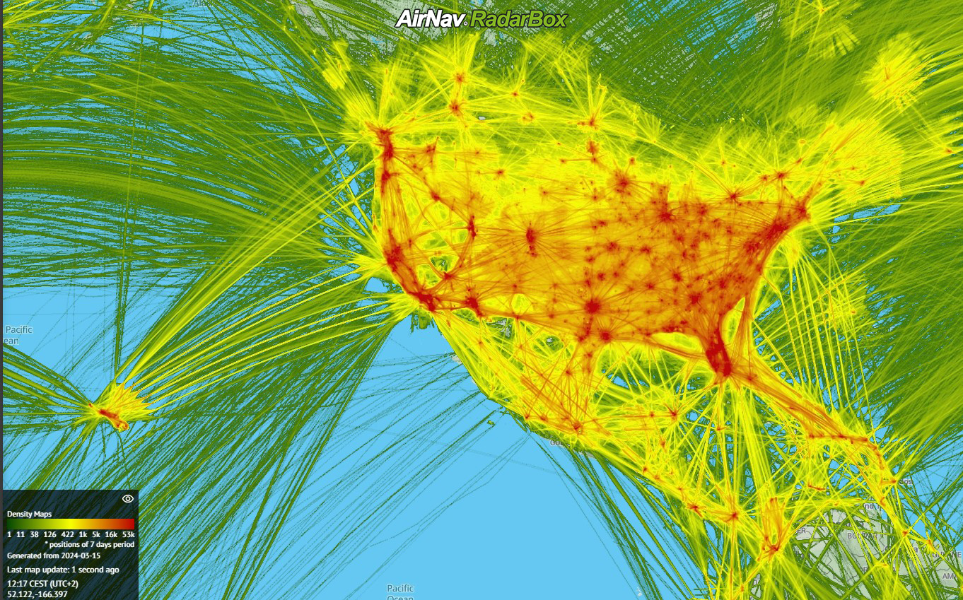
Interpreting the Density
Understanding the density of aircraft positions is critical to unraveling the story behind each map. To facilitate this, we've incorporated a handy legend in the bottom left-hand corner of the interface. This legend provides a color-coded scale, allowing users to estimate the volume of positions based on the intensity of the hue. Whether it's a bustling hub or a quieter regional airport, the legend empowers users to decipher the density easily.
Density Maps provided by AirNav RadarBox
How to Access Density Maps
Navigate to the "Map Options" menu and select "Overlays." Then, Click "Density Maps" to unlock this immersive feature. With just a few clicks, you'll journey through the dynamic landscape of global air traffic.
Density Maps provided by AirNav RadarBox
To use our Density feature, why not consider subscribing to RadarBox? Click here to subscribe!
READ NEXT...
 80795
80795Tracking Helicopters With RadarBox
Today we'll explore how to filter and track helicopters on RadarBox.com. Read this blog post to learn more...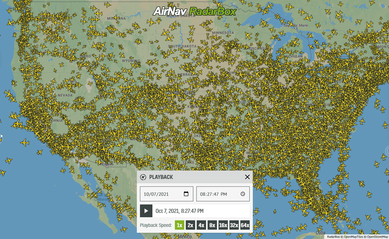 22244
22244Replay Past Flights with Playback
AirNav RadarBox officially launches the playback function on RadarBox.com, allowing users to replay the air traffic for a specific date and time in the past, within a 365-day period. Read our blog post to learn more about this feature.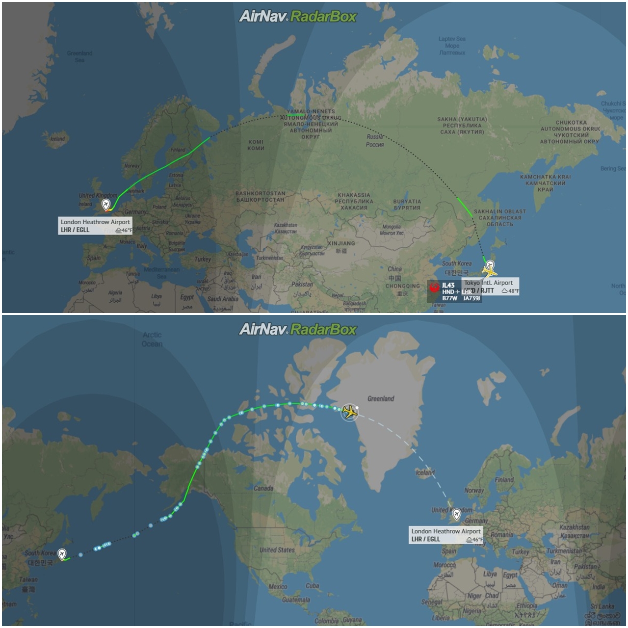 12958
12958Some airlines are flying longer than usual
Following the war in Ukraine and the airspace restrictions due to the Ukraine-Russia conflict, several airlines have been experiencing increased operating costs with detours and consequently longer flights, generating more costs. Read our blog post to find out more!